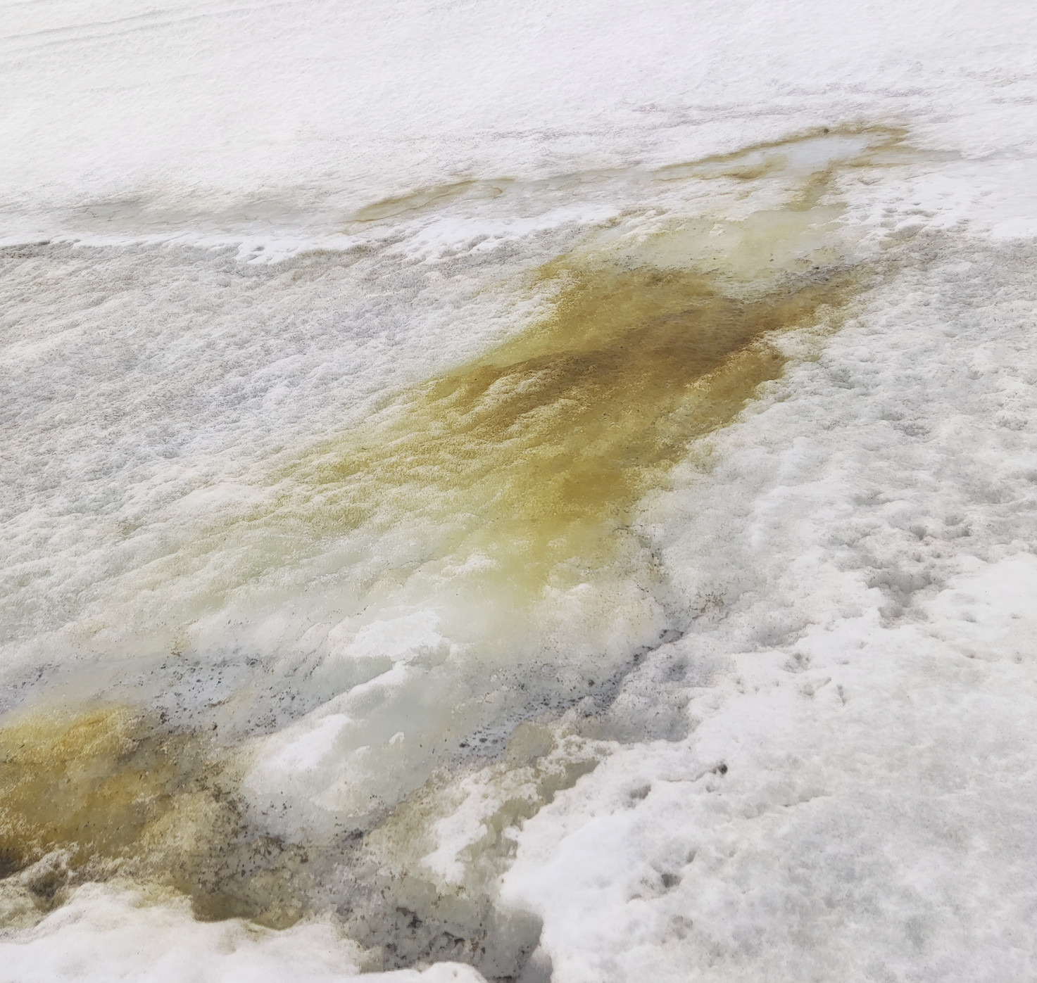
2026 - Communications Earth & Environment
Unveiling the large coverage of red snow algae blooms in antarctic coastal snowfields


2025 - Ecological Informatics
UAV imagery in natural disasters: Real-time damage assessment of flash flooding events

2025 - Scientific Data
LiDAR-based topographic data for the coastline of Port Foster (Deception Island, Antarctica)

2025 - Journal of Environmental Management
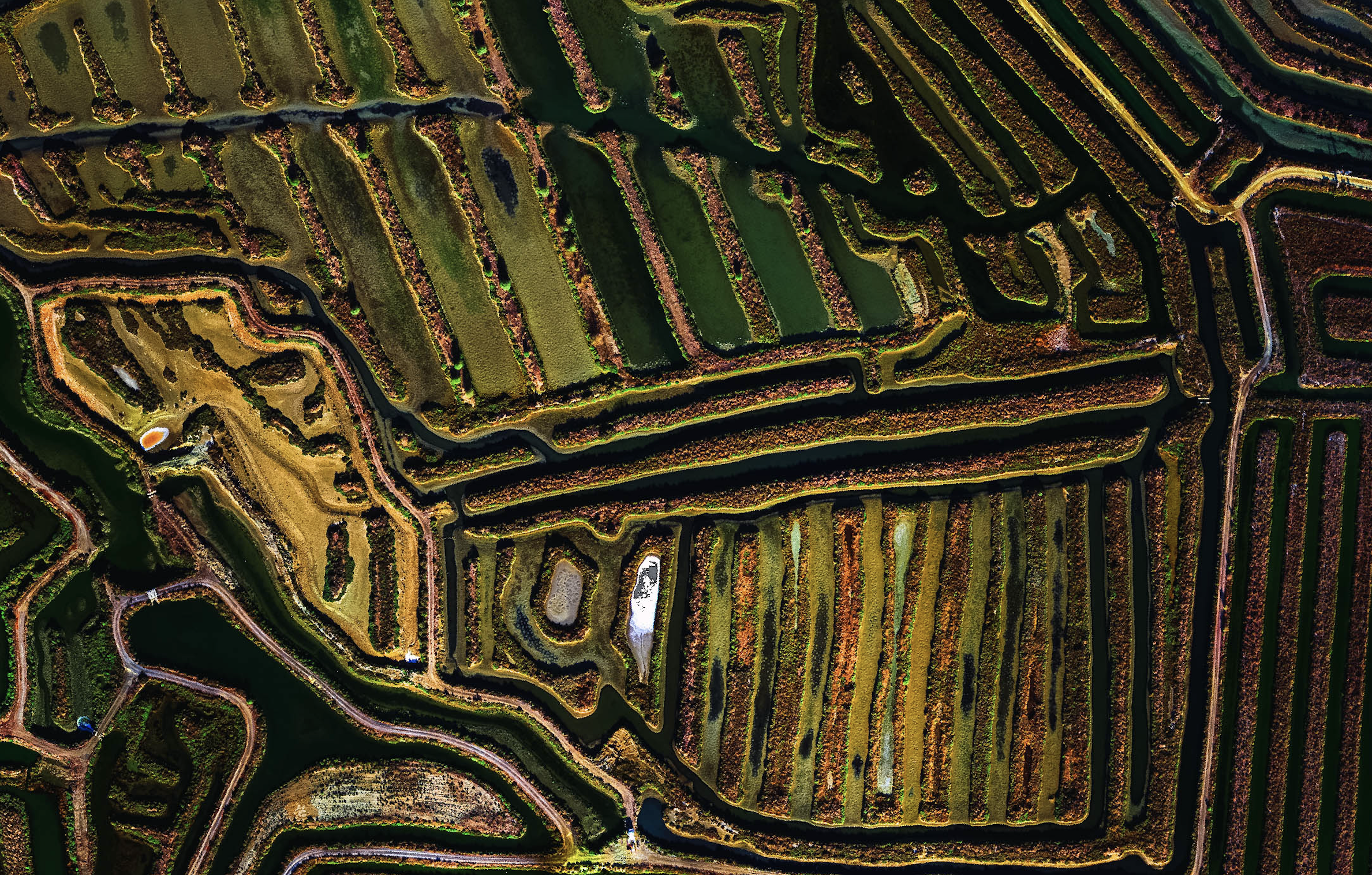
Air-water CO2 exchange in transformed saltmarshes for different uses and under various management models

2024 - Science of The Total Environment
Mapping intertidal microphytobenthic biomass with very high-resolution remote sensing imagery in an estuarine system

2024 - Int. Journal of Applied Earth Observation and Geoinformation
Assessing topographic features and population abundance in an Antarctic penguin colony through UAV-based deep-learning models

2024 - Remote Sensing of Environment
Intertidal seagrass extent from Sentinel-2 time-series show distinct trajectories in Western Europe

2024 - Communications Earth & Environment
A sentinel watching over inter-tidal seagrass phenology across Western Europe and North Africa

2024 - Scientific Data
ShetlandsUAVmetry: unmanned aerial vehicle-based photogrammetric dataset for Antarctic environmental research

2024 - Remote Sensing
Enhancing Georeferencing and Mosaicking Techniques over Water Surfaces with High-Resolution Unmanned Aerial Vehicle (UAV) Imagery

2023 - Int. Journal of Applied Earth Observation and Geoinformation
Characterization of an antarctic penguin colony ecosystem using high-resolution UAV hyperspectral imagery

2023 - Estuarine, Coastal and Shelf Science
Mapping intertidal oyster farms using unmanned aerial vehicles (UAV) high-resolution multispectral data

2023 - Remote Sensing
Water-Quality Monitoring with a UAV-Mounted Multispectral Camera in Coastal Waters

2022 - Springer
Remote Sensing: Satellite and RPAS (Remotely Piloted Aircraft System)

2022 - Frontiers in Marine Science
Monitoring the marine invasive alien species Rugulopteryx okamurae using unmanned aerial vehicles and satellites

2022 - GIScience & Remote Sensing
High-spatial resolution UAV multispectral data complementing satellite imagery to characterize a chinstrap penguin colony ecosystem on deception island (Antarctica)

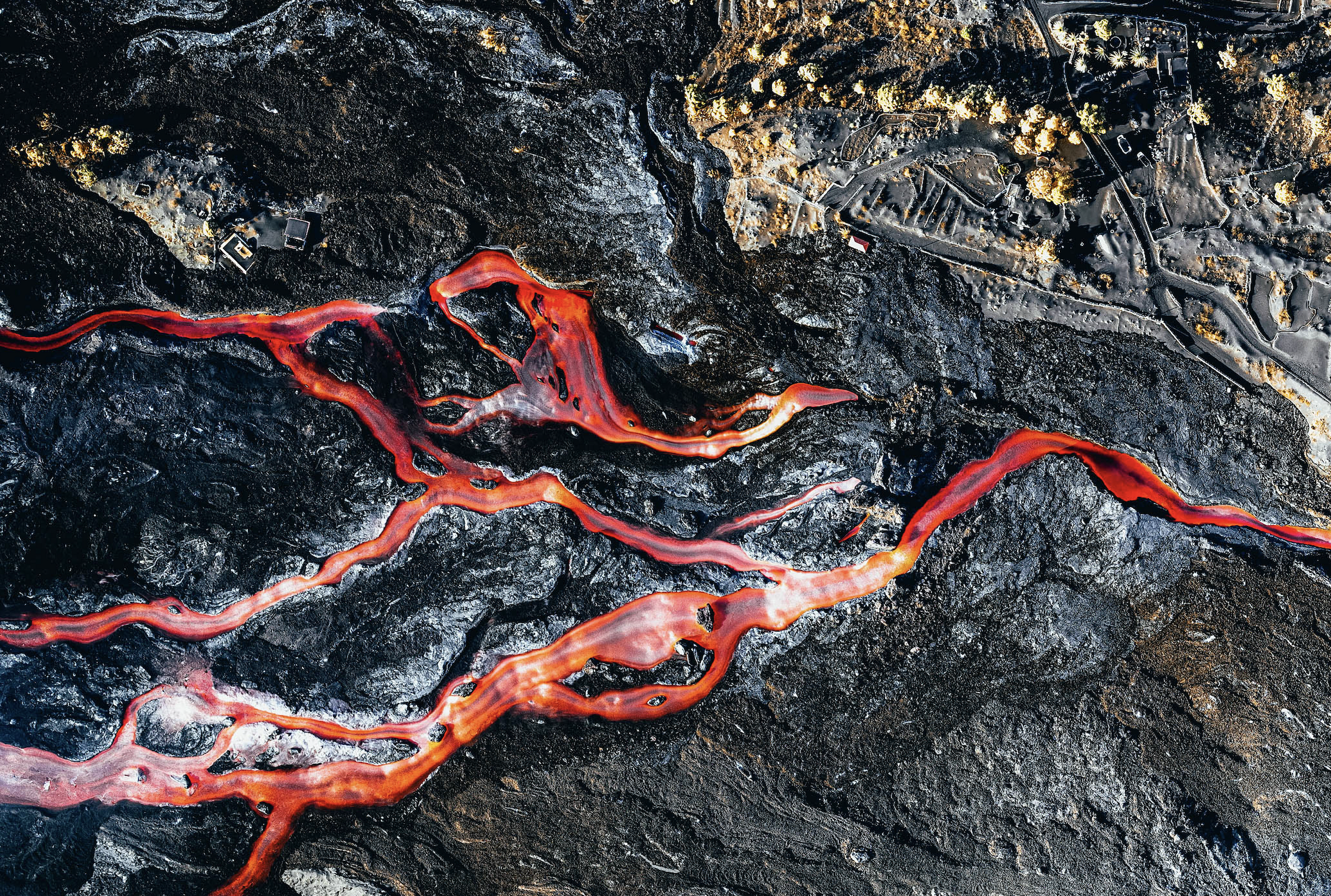
2022 - Science of The Total Environment
Unmanned aerial vehicles (UAVs) as a tool for hazard assessment: The 2021 eruption of Cumbre Vieja volcano, La Palma Island (Spain)

2022 - Science of The Total Environment
Water quality monitoring with Sentinel-2 and Landsat-8 satellites during the 2021 volcanic eruption in La Palma (Canary Islands)

2021 - Scientific Reports
Applications of unmanned aerial vehicles in Antarctic environmental research

2021 - Frontiers in Marine Science
Using a UAV-Mounted Multispectral Camera for the Monitoring of Marine Macrophytes
Publication Stats
Citations per Year
Research Impact
Research Interest Score higher than 85% of all ResearchGate members
Higher than 99% of researchers who first published in 2021